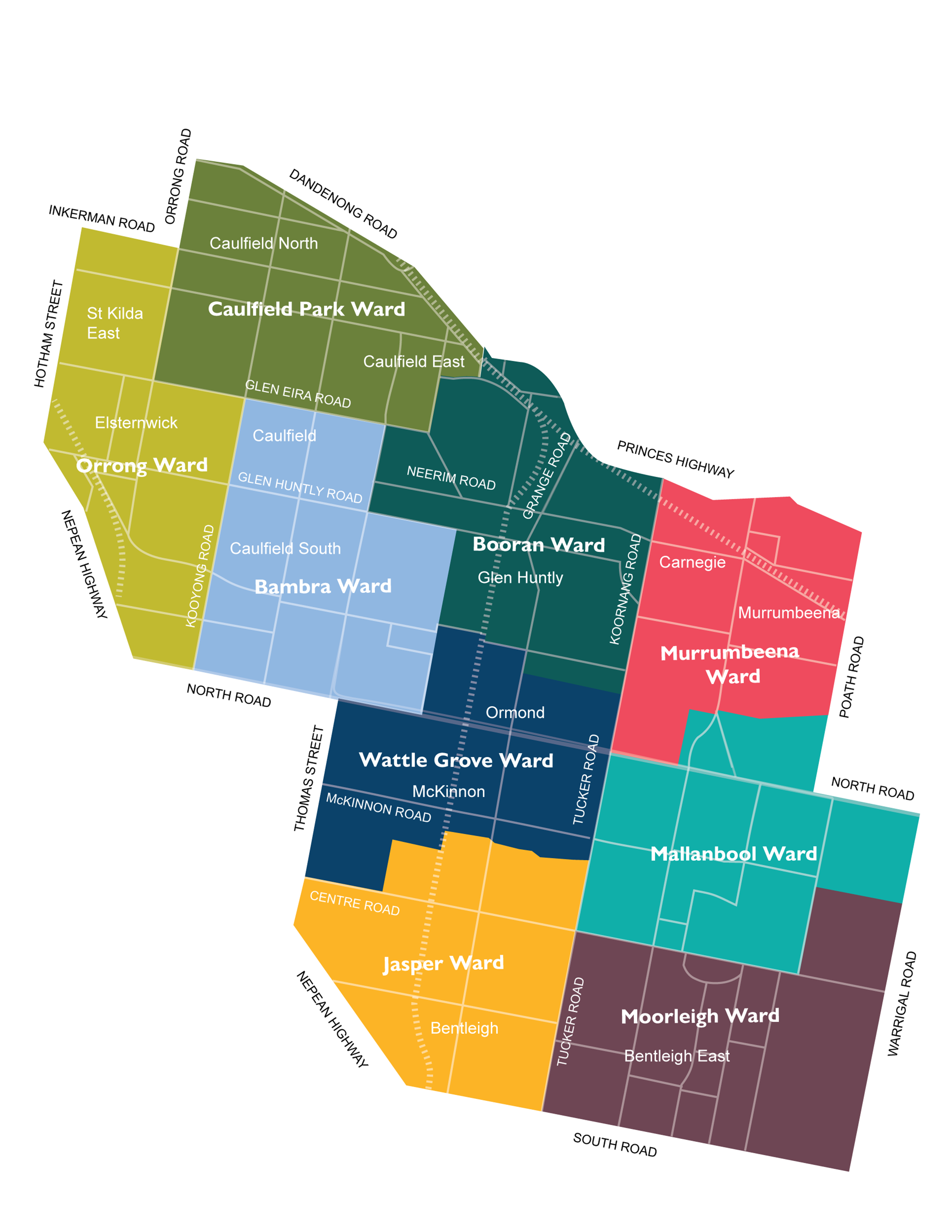
Ward map

Our City is made up of three wards with three Councillors elected to represent each ward. 

Electoral structure 

A new electoral structure and new ward boundaries will take effect from the October 2024 local government election. 


The Victorian Government’s electoral changes moved Glen Eira City Council from the existing three wards, each represented by three Councillors, to nine wards, each represented by a single Councillor. 


The nine new wards will be divided along main roads and suburb boundaries. The wards are named Bambra, Booran, Caulfield Park, Jasper, Mallanbool, Moorleigh, Murrumbeena, Orrong and Wattle Grove. 


For more information about the new wards, visit our ward boundaries map.


Camden Ward: bordered by Bambra Road, North Road, Nepean Highway, Hotham Street, Inkerman Road, Orrong Road, Dandenong Road, Grange Road, Neerim Road and Glenhuntly Road | Rosstown Ward: bordered by Bambra Road, Glenhuntly Road, Neerim Road, Grange Road, Princes Highway, Poath Road, North Road, Tucker Road and McKinnon Road | Tucker Ward: bordered by Bambra Road, McKinnon Road, Tucker Road, North Road, Warrigal Road, South Road and Nepean Highway.